
At GeoMetric Survey, we don’t just visualize the world—we reconstruct it. Our technology stack blends spatial computing, artificial intelligence, and cloud-native infrastructure to deliver a fully automated, end-to-end geospatial ecosystem. Whether it’s real-time 3D generation, predictive risk analysis, or a no-code developer interface, GeoMetric Survey empowers users to move from raw data to real-world decisions with unprecedented speed and precision.
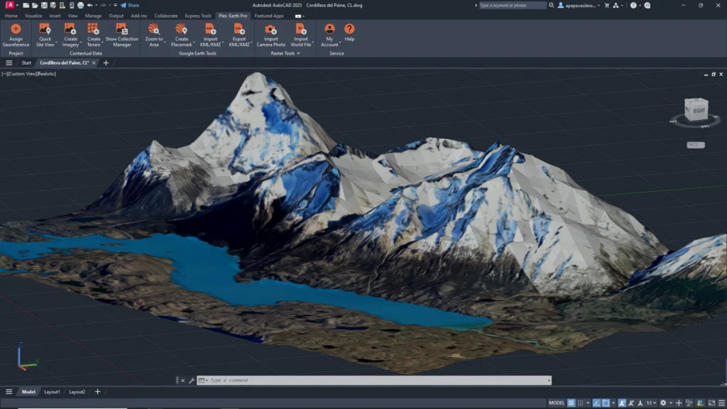
Indigenous 3D Terrain Modeling with Interactive Gamified Visualization
GeoMetric Survey delivers high-resolution 3D terrain models enriched with interactive, gamified visualization, enabling intuitive exploration, enhanced spatial understanding, precise analysis, and data-driven decision-making for smarter planning and development.
Advanced Synthetic Data Creation
GeoMetric Survey leverages advanced synthetic data creation to simulate real-world environments, enhance geospatial analytics, improve modeling accuracy, reduce data gaps, and support smarter planning, training, and decision-making across diverse surveying applications.
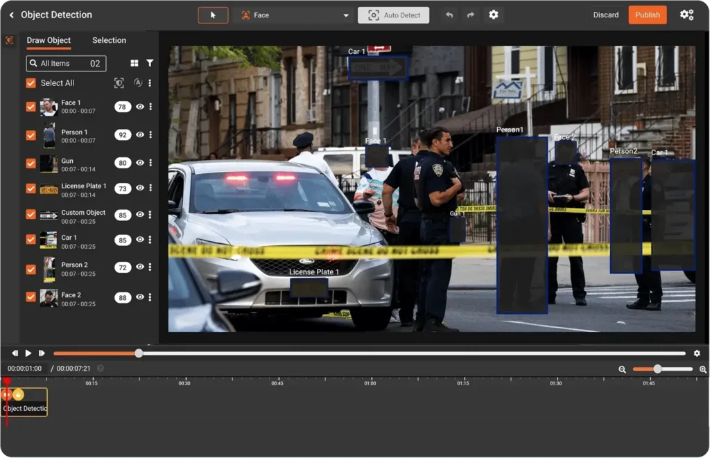
AI-Powered Object Detection
Advanced object detection driven by artificial intelligence enables accurate identification, classification, and tracking of objects in real time. By leveraging deep learning and computer vision, it enhances surveillance, monitoring, automation, and data analysis with speed, precision, and scalable performance across diverse environments.
3D Digital Twin–Based Simulation, Analysis and Predictive Generation
GeoMetric Survey delivers advanced 3D digital twin–based simulation, in-depth analysis, and predictive modeling to visualize assets, assess performance, anticipate risks, and enable data-driven planning for smarter, resilient infrastructure development.
No-Code Developer Framework with LLM Integration
GeoMetric Survey offers a no-code developer framework integrated with LLM technology, enabling rapid solution building, intelligent automation, seamless data interaction, and scalable geospatial applications without complex coding requirements.


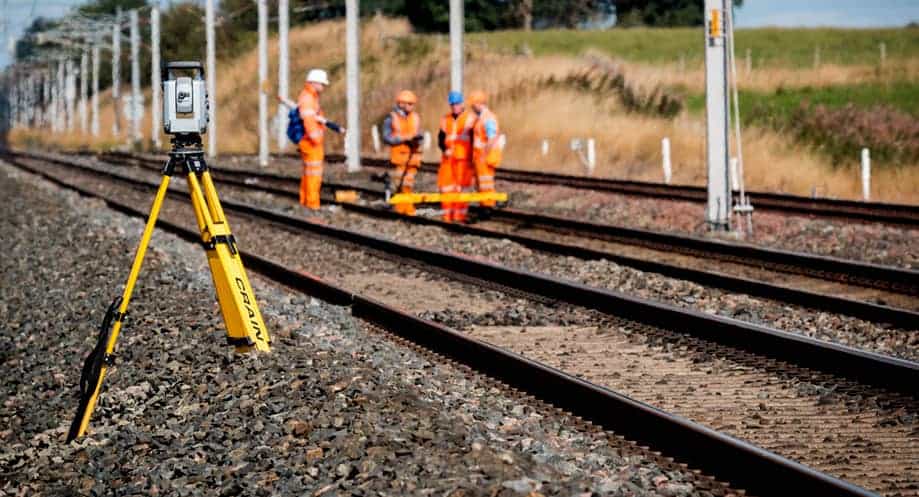
Scalable Deployment with Multi-Sensor Integration (360° Cameras, Drones, CCTV, IoT)
GeoMetric Survey enables scalable deployment with seamless multi-sensor integration, including 360° cameras, drones, CCTV, and IoT devices, delivering real-time data capture, comprehensive monitoring, and intelligent geospatial insights for dynamic environments.
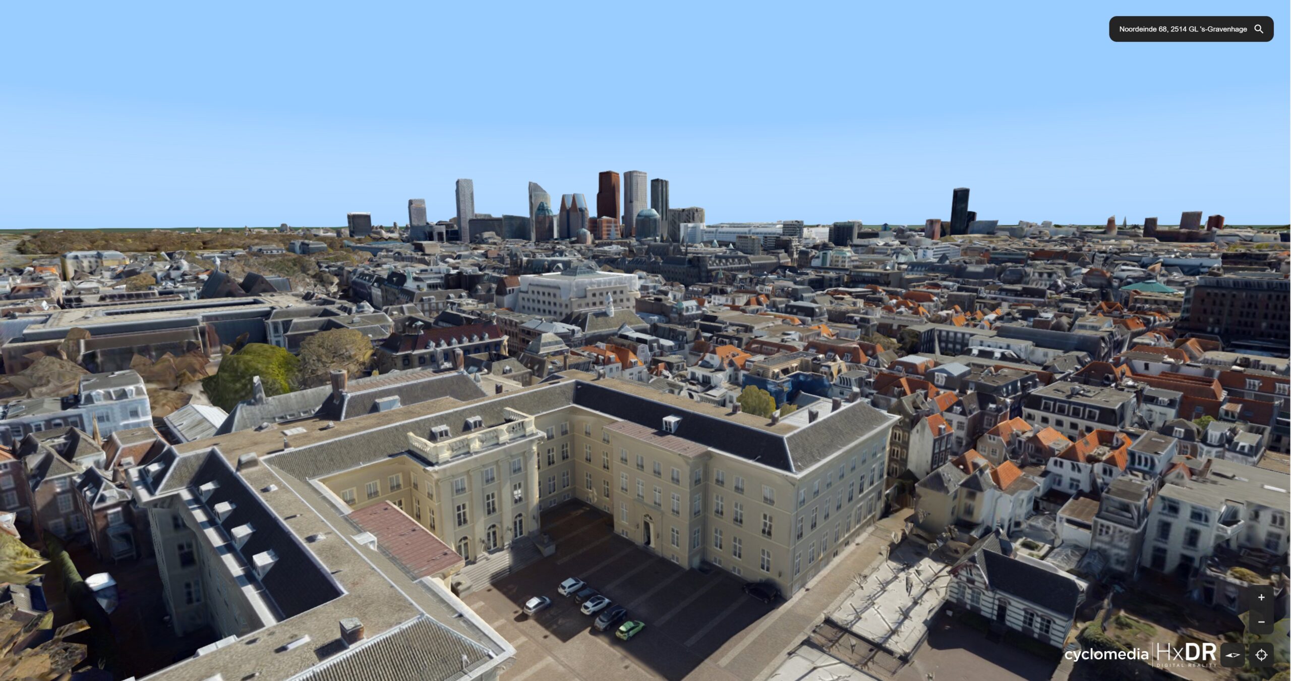
AI-Powered Image Processing
GeoMetric Survey utilizes AI-powered image processing to enhance aerial and ground imagery, automate feature detection, improve accuracy, extract actionable insights, and accelerate geospatial analysis for smarter planning and infrastructure management.